The sharp-eyed among us will have noticed Seattle Dept. of Transportation crews hard at work along Holman Rd and 15th Ave NW this week. MyBallard.com gave advance notice of the work here. The work is being done to provide more information for drivers and transportation agencies during the Alaska Way Viaduct Replacement Project. During the life of the project, SDOT and Washington State DOT expect that Holman Rd and 15th Ave traffic will increase dramatically. These projects are supposed to allow drivers to make better decisions, smooth the flow of traffic, and provide real-time information to SDOT and WSDOT on traffic conditions.
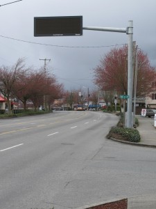
The first change was the installation of a traffic information sign over the southbound lanes of Holman Rd at 14th Ave NW. The sign will be used to inform drivers of accidents and road conditions ahead to the Ballard Bridge and beyond. This is similar to the informational signs on I5. The sign is approximately 1 block east of the radar speed sign located near Mary Ave NW.

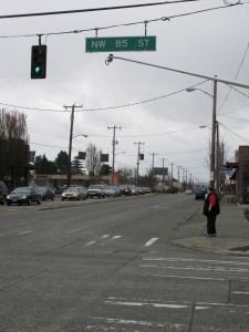
The second change was the installation of traffic cameras at the intersection of 15th Ave NW and NW 85th St. These cameras will allow monitoring of traffic conditions. The cameras will not be used for red light enforcement like the cameras at 15th and 80th. SDOT previously announced the traffic cameras here and at other locations city-wide as part of their traffic information system. We will soon be able to view traffic images from the cameras showing current traffic conditions on the city’s Traveler’s Information Map. These cameras are supposed to go live this month (March 2010) according to the MyBallard article from last year.
The Alaska Way Viaduct replacement project is expected to be completed shortly after the demolition of the Viaduct. The Viaduct will be demolished in 2016 according to preliminary estimates. A timeline for the replacement project is available at WSDOT’s web site here. There will be a multi-year period during which traffic normally handled by the Viaduct will be diverted to I5 and surface streets such as Elliott Ave W, 15th Ave NW, and Holman Road. We can expect significant traffic impacts during the construction. Once completed, SDOT estimates it will take a Crown Hill resident 4 or more extra minutes to get to the southern end of the tunnel than it does today. This is due to the fact, the northern entrance to the tunnel will be located further East than the current route to the viaduct.
To learn more about the Alaska Way Viaduct Replacement project, visit SDOT’s project web site at: http://www.seattle.gov/transportation/awv.htm Additional information is available on the state’s DOT website at: http://www.wsdot.wa.gov/Projects/Viaduct/default.htm A document describing the impacts on Ballard is available here: http://www.seattle.gov/transportation/docs/NWSeattleBrochureREVISED.pdf
