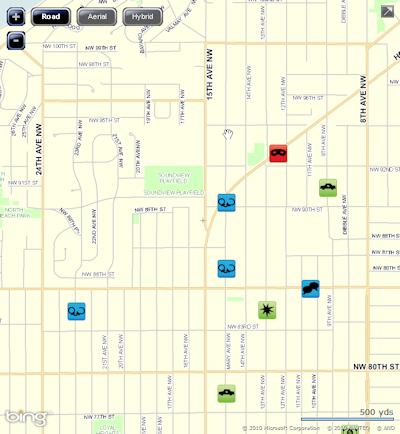
The Seattle Police Department recently announced their new publicly available crime mapping tool. The crime maps coordinate with the police reports available online (registration and sign-in required). The map is zoomable, positionable, and can be searched by address or neighborhood. Each type of crime is indicated by a different icon. “Rolling” the mouse cursor provides a handy way to decode the heiroglyphs, plus a rough address, and a link (if available) to the police report on the incident.

Crimes will be marked on the map within 12 hours of occurrence and will either link to a redacted police report or a “GO” (General Offense) number. The police reports may lag several days behind the appearance of the icon on the map.
After playing with it for a few minutes, I am struck by how little crime is present in Crown Hill (and Ballard) compared with parts of Seattle South of here.
